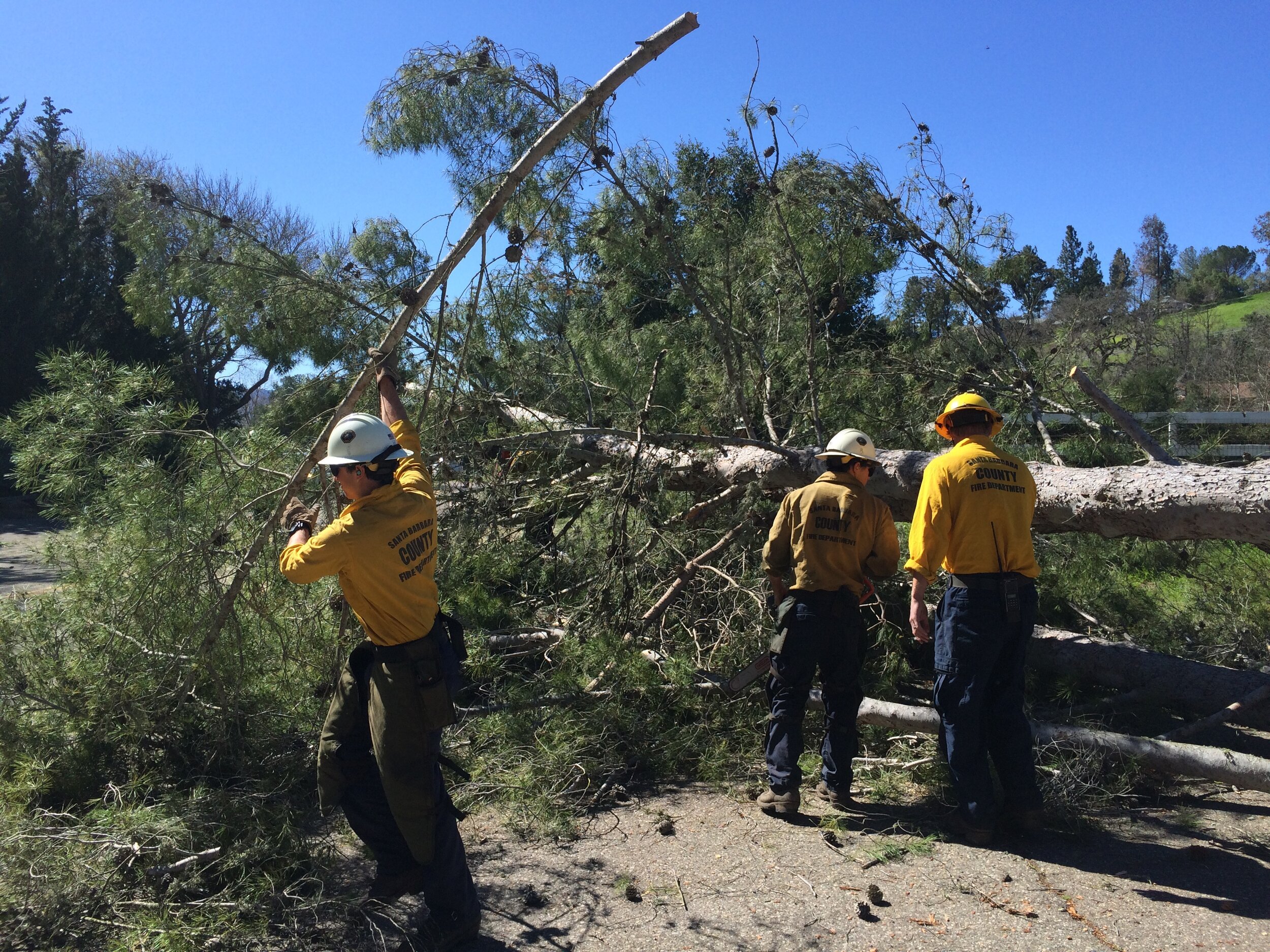
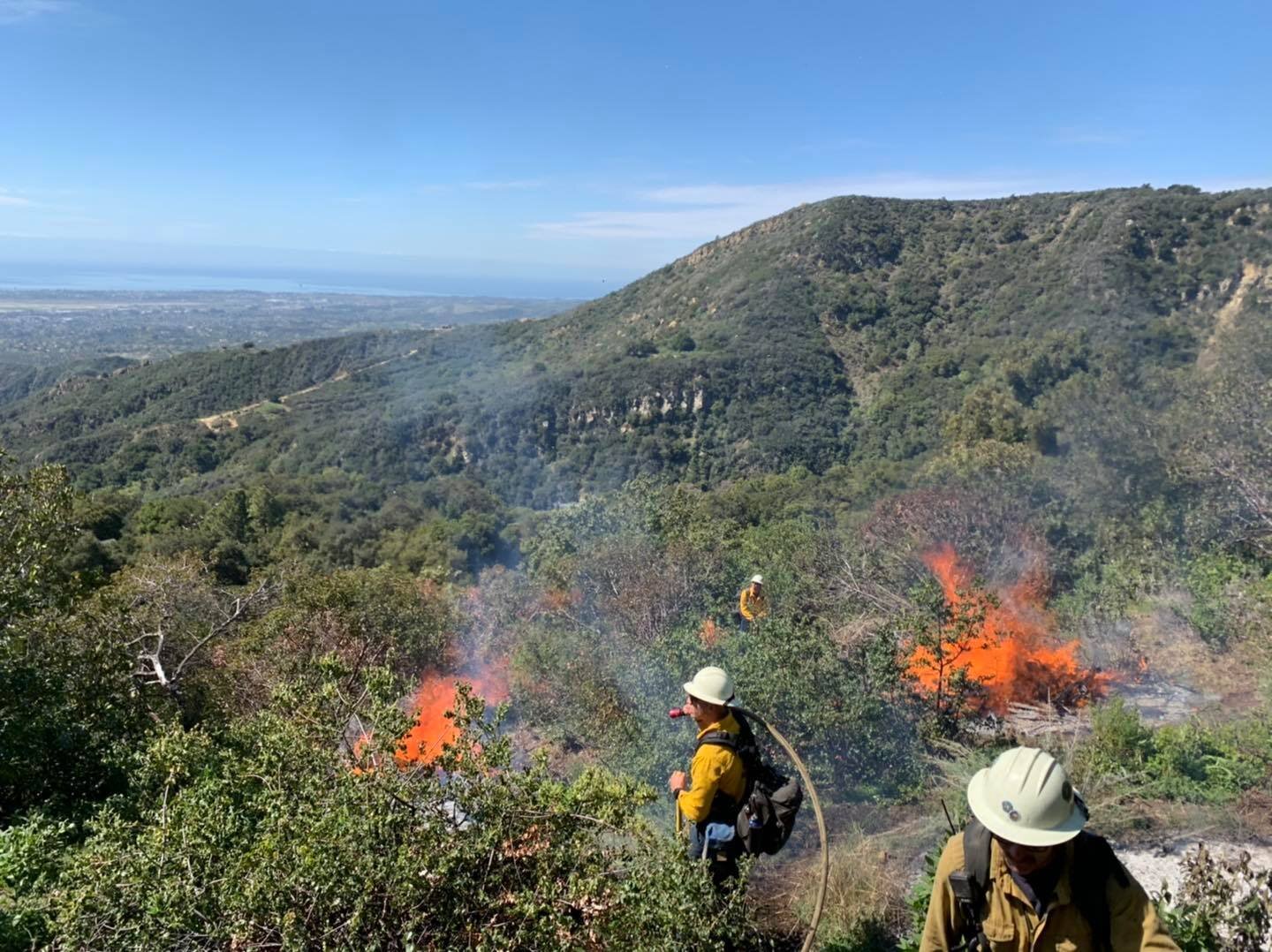
![](https://images.squarespace-cdn.com/content/v1/64e7d9290074df62c8ffbfe3/0676b60b-fc27-4a1b-9db2-a04302b06b8f/chipping.jpg)
New
Create a regularly occurring opportunity for cross sector sharing learnings and collaborating on potential policy, actions and projects.
Develop and pilot a replicable process and framework for developing wildfire resilience plans for housing developments in high fire risk areas.
Create and implement an education program to build youth resilience to climate change induced crises. This project builds local capacity to quickly respond to wildfire and other disasters in a coordinated and responsive way.
Create a fund to study ecological/ecosystem recovery processes. Studies would include, at a minimum, a baseline biological assessment after every disaster, to identify sensitive natural communities, threats (i.e. invasive species vectors/vulnerabilities) and priorities for mitigation/restoration.
In Progress
The Parks and Recreation Department and Fire Department have partnered to improve the community’s fire resilience and reduce the risk and severity of wildfires. The collaboration balances the expertise of both teams to manage vegetation while protecting the natural ecosystems within the city’s open space parks. This work is a critical component of Santa Barbara’s Community Wildfire Protection Plan.
Create and implement an education program to build youth resilience to climate change induced crises. This project builds local capacity to quickly respond to wildfire and other disasters in a coordinated and responsive way.
Host a series of convenings or summits to develop a framework for a community supported grazing program.
Implement a Prescribed Fire Training Exchange (TREX) and cooperative burns to provide experiential training that builds robust local capacity for…
In June of 2021, the Land Trust of Santa Barbara received a grant of $23,588 from the Coastal Conservancy for a targeted prescribed grazing project at the Arroyo Hondo Preserve, a project that the RPP team had identified through their outreach efforts to the Land Trust and helped facilitate funding for.
The Fire Wise Project is a collaborative effort among multiple agencies and institutions in the Santa Barbara area, including UCSB, Westmont College, and the SB Botanic Garden.
The Lompoc region has been identified as a high priority for fire prevention activities by the modeling completed by the RPP team but the region lacks a Community Wildfire Protection Plan (CWPP).
The restoration recommendations detailed in other restoration items in the Regional Priority Plan would also require the removal of invasive and non-native species from other high priority areas in the WUI.
Healthy riparian corridors with natural unimpaired hydrology are natural fire breaks, with well watered vegetation acting to catch and extinguish embers and dampen fire advancement.
Partially Funded/Partially Underway
Develop and pilot a replicable process and framework for developing wildfire resilience plans for housing developments in high fire risk areas.
Many agencies and community based organizations maintain GIS data for internal purposes and needs. As a result, there are multiple specialized systems for particular needs and redundant technical capacity.
The communities throughout Santa Barbara County have varying degrees of wildfire buffer along their WUI edges. Goleta benefits from significant portions of its WUI edged by irrigated orchards
In June 2021, the Santa Barbara County Fire Department received funding from the State Coastal Conservancy to implement a community defensible space project in the San Antonio Creek area foothills.
There is a long term need to acquire Santa Barbara County wide, cross jurisdictional, LIDAR data in addition to the periodic orthographic overflights that are undertaken for aerial mosaic mapping product needs.
Paradise Road and other public land recreation areas throughout the County are highly visited community resources utilized by all income levels. These areas often include fire pits, grills and picnic areas where…
A parallel effort to the countywide planning effort is to engage existing prescribed grazing contractors and potential new entrants to assess existing capacity and understand…
Completed
Parma Park is a City of Santa Barbara owned 200-acre open space park located within the extreme foothill zone of the high fire hazard area. The park is composed of twelve different vegetation communities. The native bigpod ceanothus chaparral community makes up a majority of the park space, followed by the coast live oak woodland and forest community.
Honda Valley Park is a City of Santa Barbara owned 48-acre open space park located within the coastal interior zone of the high fire hazard area. The park has diverse, dense vegetation along steep slopes and within canyons, as well as a heavy understory of invasive plants and thatch.
In June 2021, the Carpinteria Summerland Fire Protection District received funding from the State Coastal Conservancy to conduct a multi-pronged fuels reduction treatment program…
Prescribed fire can help reduce fuel loads in key areas that are safe to burn and where there has been a dearth of fire in the past.
Tepusquet Canyon includes underserved communities and low income migrant workers, making this a high priority area from an equity perspective.
Prescribed grazing (also known as prescribed herbivory) enables fuel treatment in sloped and difficult to access areas where other vegetation management options are challenging or impractical.
Recommended
Create a regularly occurring opportunity for cross sector sharing learnings and collaborating on potential policy, actions and projects.
Create a fund to study ecological/ecosystem recovery processes. Studies would include, at a minimum, a baseline biological assessment after every disaster, to identify sensitive natural communities, threats (i.e. invasive species vectors/vulnerabilities) and priorities for mitigation/restoration.
Develop a replicable framework for creating a fire-safe landscape with healthy ecological function in post-fire recovery areas …
The Cachuma Resource Conservation District (CRCD) plays a critical role in our community as a partner to and bridge between farmers, ranchers and other landowners and conservation groups and agencies focused on the health of our land, water, soil, wildlife, agriculture and food systems.
Community Wildfire Protection Planning is a structured process that helps communities assess their preparedness for wildfires, identify priority actions and secure policy guidance from their elected leaders so that fire protection agencies…
Santa Barbara County Fire Department (SBCFD) serves as Santa Barbara County's Cal Fire Unit and regularly produces an Annual Strategic Unit Plan as mandated by Cal Fire that inventories the fire prevention projects SBCFD has in various stages of its planning and implementation processes.
The Los Padres National Forest (LPNF) undertook a planning effort to identify, prioritize and plan a series of fire prevention and mitigation activities to reduce the risk of wildfire to mountain communities including West Camino Cielo, Painted Cave and Rosario Park.
While several areas of Santa Barbara County benefit from the preparation of Community Wildfire Protection Plans, there are several areas of the County that do not currently have a plan that covers them.
Guadalupe City leaders noted that an area next to Leroy Park and adjacent to the Santa Maria River is considered a high fire risk to nearby vulnerable population concentrations.
Roadside vegetation management is a high impact fire risk reduction activity and is needed in high fire risk areas throughout the county. The RPP team recommends engaging local fire …
Reducing combustible vegetation in the immediate vicinity of homes, other buildings, infrastructure and transit corridors is one of the most effective actions available for fire risk reduction in the county.
A key SBC Fire Department leader shared that Santa Barbara County needs to increase the pace and scale of fine scale mapping of built and natural resources to facilitate effective planning and avoid unnecessary conflicts.
Much like roadsides, vegetation along railroad corridors creates risk of fire ignition and spread. With the increasing prevalence of homeless encampments along road and railroad corridors, particularly in and near urban areas…
When fires occur, they often start in areas of the national forest and enter into the unincorporated WUI portions of the County. There is a need to conduct detailed mapping of invasive, flammable vegetation or other fire risks…
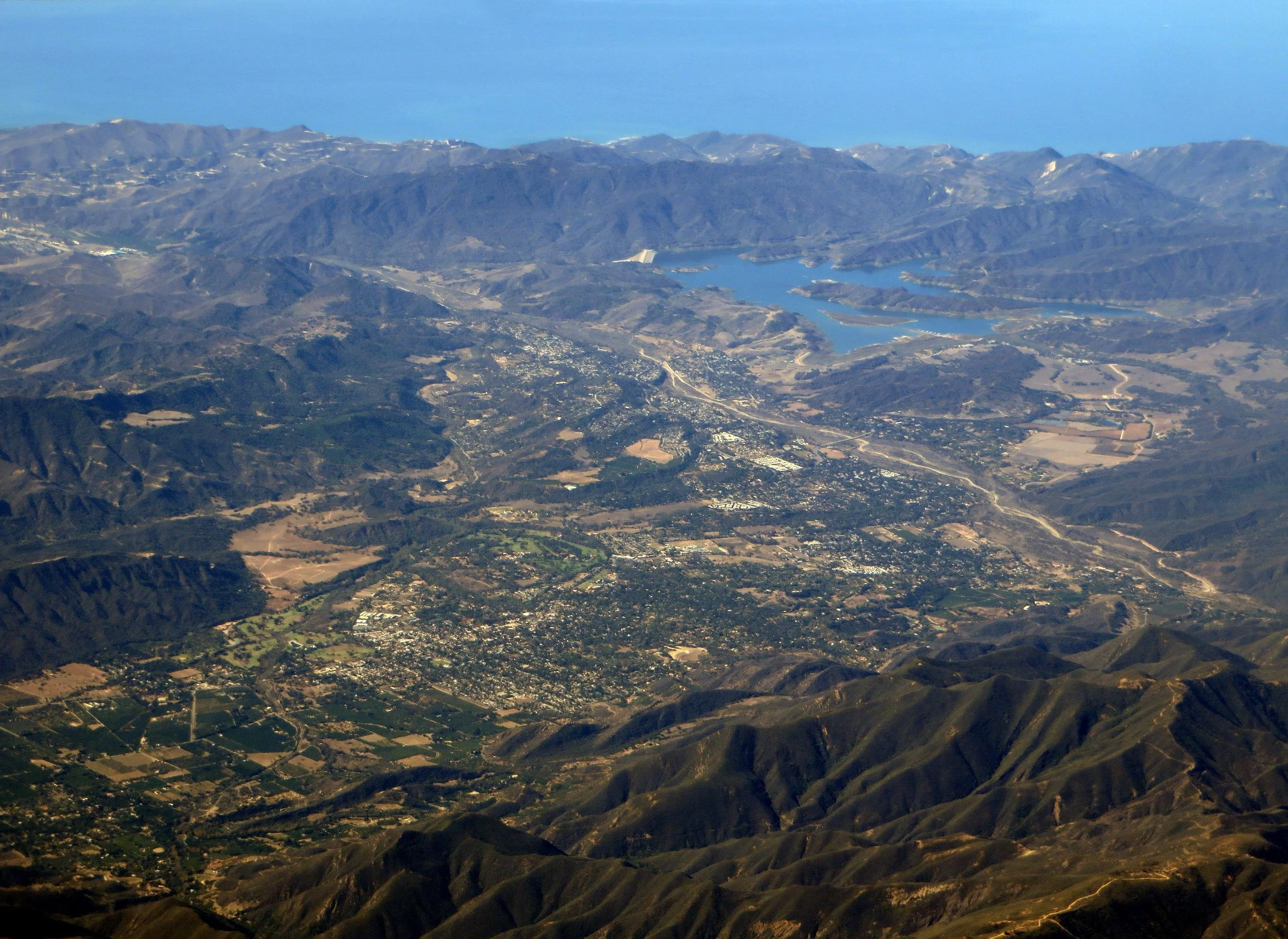
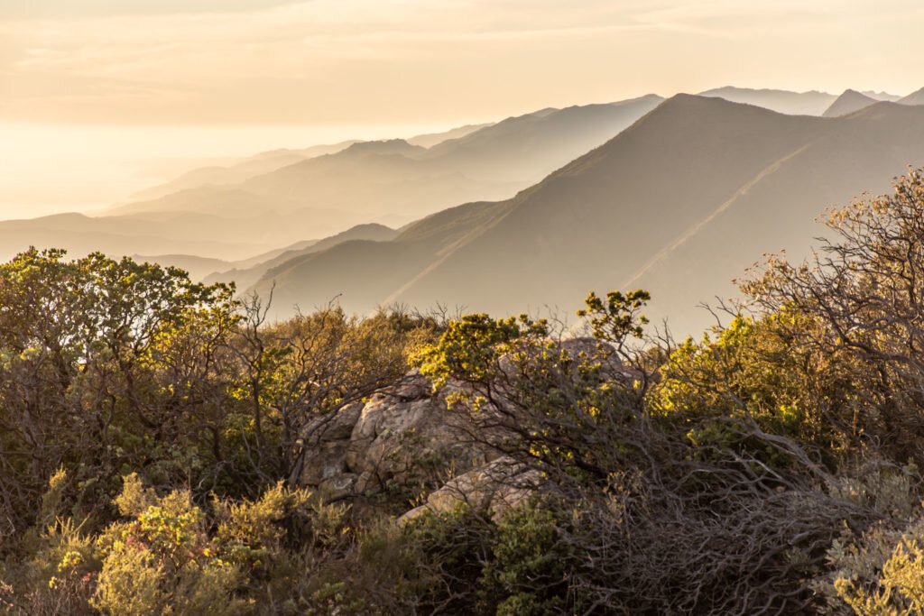
The Nature Conservancy stewards the 24,000-acre Jack and Laura Dangermond Preserve (JLDP) at Point Conception. JLDP is of biological and cultural significance regionally and globally.